Envisioning Risk of Hurricane Storm Surge and Sea Level Rise
9:00 am – 5:00 pm MDT
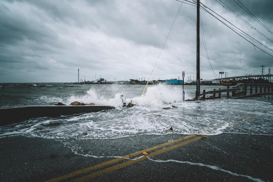
Flooding associated with hurricane storm surge and sea level rise presents serious threat to many coastal communities in the United States and around the world. Reducing and managing risks from storm surge is challenging due to the complex relationships among the physical, social, and behavioral dimensions of the hazard, the inherent uncertainty in storm surge forecasting and sea level rise prediction. Novel approaches in geospatial visualization of multi-dimensional scientific information provide exciting opportunities to better understand coastal hazards and visually communicate the risks and threats to the public.
The 2019 BRIGHTE workshop will provide an opportunity for participants to embrace an interdisciplinary approach to science of coastal flooding, explore innovating ways to visualize storm surge forecast and sea level rise projections in 2D and 3D GIS environments, and learn about science communication using Story Maps. The workshop will include science presentations, hands-on GIS training on data visualization, group projects on science communication, and a poster session. The hands-on GIS exercises will include:
- working with probabilistic storm surge forecasts from NOAA’s National Hurricane Center GIS archive;
- exploring questions of spatial scale and uncertainties associated with the sea level rise projections;
- explore different techniques to visual storm surge and sea level rise in a 3D environment;
- integrating science and geospatial visualization concepts into Story Maps.
Because the problems of sea level rise and preparedness and response for coastal hazards, such as hurricane-related storm surge affect diverse coastal communities in this country, it is especially important that representatives from all communities are engaged in the sciences, decision-making, and effective risk communication strategies. Students, early career researchers, and faculty, who are interested in applying GIS technology in research and education addressing impacts of coastal flooding, will benefit from attending this workshop. Faculty and students from junior colleges, Historically Black Colleges and Universities, Tribal Colleges, and Hispanic-Serving institutions from the U.S. Eastern Seaboard, the Gulf of Mexico and the West Coast are encouraged to apply. All selected participants will receive travel support and per diem to attend the workshop.
The workshop is funded through the NCAR’s Research Applications Laboratory Diversity Funding Program. It is a repeat of our workshop held July 31-Aug 3, 2018.
Contact
Please direct questions/comments about this page to: