GLOBathy: A Global Lake Bathymetry Dataset
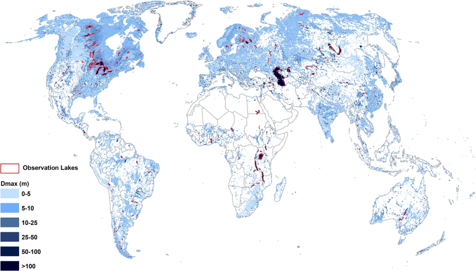
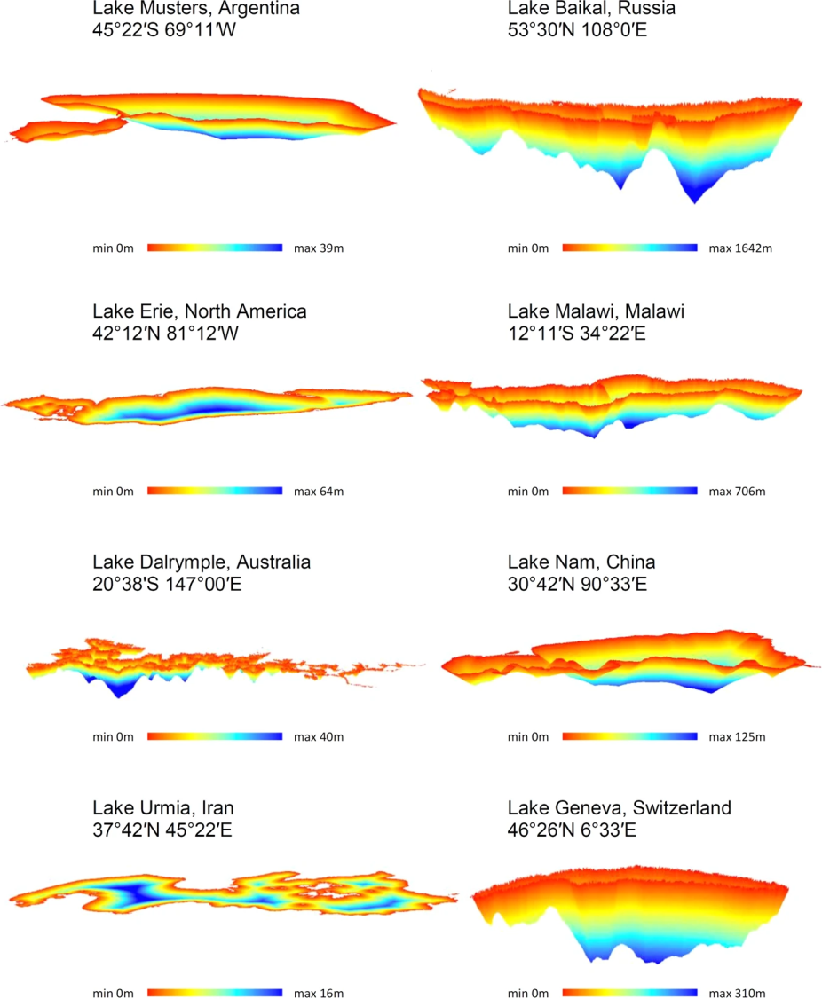
Bathymetric maps for selected waterbodies in the GLOBathy dataset.
Waterbodies (natural lakes and reservoirs) are a critical part of a watershed’s ecological and hydrological balance, and in many cases dictate the downstream river flows either through natural attenuation or through managed controls. Investigating waterbody dynamics relies primarily on understanding their morphology and geophysical characteristics that are primarily defined by bathymetry. Bathymetric conditions define stage-storage relationships and circulation/transport processes in waterbodies. Yet many studies oversimplify these mechanisms due to unavailability of the bathymetric data.
A new dataset has been developed at NCAR which provides estimated lake bathymetry data for over 1.4 million lakes and waterbodies world-wide. Starting from the popular HydroLAKES dataset, bathymetric maps were generated using a GIS-based framework, combining the lake polygon geometry with a machine learning-based estimate of lake maximum depth. Validated using more than 1500 surveyed bathymetric maps, this dataset provides estimates for the area and volume at any lake stage or depth, providing essential information for hydrological or water-balance studies. The bathymetry maps are available at 1 arc-second resolution and the code for generating new lake bathymetry estimates are packaged together with the GLOBathy data.
Jounral Arcticle page: https://doi.org/10.1038/s41597-022-01132-9
Direct link to PDF: https://www.nature.com/articles/s41597-022-01132-9.pdf