New climate simulations are available in GIS formats
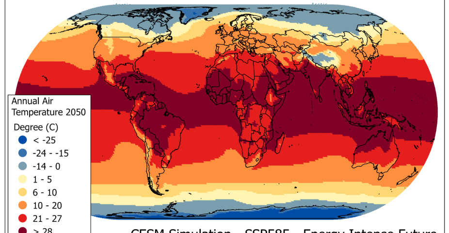
Global climate simulations from the Community Earth System Model (CESM), that were produced at NCAR for the 6th Assessment Report of the IPCC and are part of the Coupled Model Intercomparison Project Phase 6 (CMIP6), are now available for download in a number of tabular and geospatial (GIS) formats. We allow for data (model grid centroids) to be extracted and downloaded in Shapefile, GeoJson, GeoPackage, and CSV formats. The climate simulations have been aggregated at temporal resolutions of monthly means, annual means, and 20-year averages. Climate anomalies have also been calculated. New to the CMIP6 model simulations are the latest version of climate and economic scenarios which are based on a set of Shared Socio-economic Pathways (SSPs). These SSP-based scenarios combine narratives of societal development over the next century (the SSPs) with the Representative Concentration Pathways (RPCs). While the SSPs describe alternative futures with regard to development, population, urbanization, economy and technology, the RPCs describe trajectories of change in atmospheric greenhouse gasses and aerosol concentrations over time. This interactive application provides easy access, subsetting, and downloading of CESM climate simulations for analysis and mapping in GIS tools.


